Sierra de Gredos
Here I am, and here is my new trip. I look at it as a preparation for my summer vacations, because it happened in time of year when you are not on a vacation, but you sure feel like it.
Let's start with the basic. My trip occurred on May 16 to May 19, 2019.
We started our trip bright and early. After more or less 3 hours drive, we stopped to a Moreruela Abbey (Monasterio de Santa María de Moreruela). Now, let me be perfectly clear, the thing that appear before us was stunning, but it was complete waste of time to come here.
Now you are probably asking me why? Well, for two reasons. First: it was not open yet, and it was 9:40 AM. And second: dogs are NOT ALLOWED! So, can someone please explain to me why the heck dog can not enter some yard of some ruin???
Don't even have photos to show you, because I couldn't get close.
If anyone is interested to go to this place, here it is on a map.

So, I was there looking cute and nothing more. Then we hit the road again.

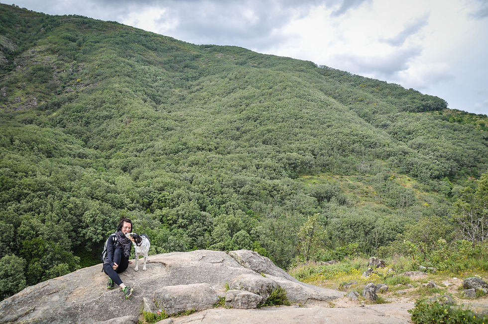
Almost five and a half hours more in the car, and we get to our first route Garganta de los Caballeros.

La Garganta de los Caballeros is a watercourse in the western part of the Sierra de Gredos, province of Ávila, Spain. Born in the municipality of Navalonguilla, in the homonymous lagoon about 2000 meters high near the peak of Covacha. It flows into the Tormes river, tributary of the Duero between the towns of Navatejares and Los Llanos de Tormes.

It started good. Trail was easy, beautiful views, we just had one problem. It was hot that day...way too much! But we kept going.

And there, my human went crazy (let me be clear, I mean positively crazy) about lavender. There are endless fields of lavender, behind every rock... I mean, practically everywhere, and she loved it! Me? Not so much.
So we passed the point of green fields, and we got to the "rocky" path, and all of a sudden, we felt like somebody is watching us. And there it was, our first chamois of the day, looking at us.

The chamois is a species of goat-antelope native to mountains in Europe. It is a a small bovid that have short, straightish horns which are hooked backwards near the tip, the horn of the male being thicker. That being said, I think this one was a male.
They are pretty amazing creatures. They can run at 50 km/h and can jump 2 m vertically into the air or over a distance of 6 m. So you can clearly see that if I pick a battle with this one, I lose for sure... so I let it slide.

So I just stand there and looked while my new friend was jumping happily to a wilderness.

We continued for about 4 km (I can't say for sure), and it seemed like forever because of the heat. Let me be clear, it is easy trail and wonderful nature, but the heat was killing us! So we took the first opportunity where we saw that we could go down to the river, and where it is safe to do it. I sure put my tired paws into the water, and it felt like heaven.

And then I felt like I was having déjà vu!

We continued after this short break, and I sure wanted to know where my buddy went.

As you can see now, our path turned to an uphill road made of rocks, and no access to a river. So we went a bit further, and we decided to go back, because we already had sunburns! All of us. In a case you want to go visit this place, please be smarter than us. Bring sun-protector!

On my way back, I saw the real ability of my buddies. This one was, literally, climbing smooth rocks at almost 90º. I tried to copy him, but no luck...so I did what I know best: I soaked my tummy whenever I could.

We also had out "backpack" lunch in the shadow of a tree, surrounded by lavenders. By the time we got to the car, it was about 5 PM, so we decided we have time to visit one place before we go to a place where we are staying.
We roamed a bit the streets of El Barco de Ávila, and visited castle Valdecorneja.


This is a castle from the 12th (XII) century, and it was built on the Tormes River at the highest point in the valley. Nowadays it is a home for a numerous stork families.
From there, about 12 min drive, it was out place to sleep. It is a rural house that goes by the name El Loboratorio, and name of the house we stayed in is La casa de al lado (literally translated: The Nextdoor house).
All recommendations for this place. It is AMAZING!!! It is extremely PET FRIENDLY! I even had a welcome gift. I mean, what is not to like about this place when they have this logo. My human absolutely love it!

Place is equipped with everything you need, and owner is so kind. Definitely is a place to visit more than one time!
With our batteries charged, we are ready for a new day!
Little less then 30 minutes drive from El Loboratorio, we started our next route. It was a fine morning, with a bit of a clouds, just perfect for walking. My humans said we are going to visit the Garganta de los Infiernos (eng. The Gorge of Hell).
We parked here, and from there we started our route. This time, route was circular, as you can check here. We prefer it that way, but If there is no other way, we are doing it back and forth. Later, on our way back, we sat there to eat, because there is area with the picnic tables nearby.
To start the route you enter the forest, and not far away from that some spectacular views starts to show.

The Natural Reserve of the Garganta de los Infiernos belongs to the "Network of Protected Natural Areas of Extremadura".
It is located in the Jerte Valley region, north of the province of Cáceres. Located on the southern slope of the Sierra de Gredos, a mountain massif belonging to the Central System, it borders to the north with the Jerte River, to the east with the Sierra de Gredos (Ávila), to the south with the region of La Vera (Cáceres) and to the west with the Putopadre stream. It is included between the municipal terms of Tornavacas, Jerte and Cabezuela del Valle.
Enough about geography. Let me tell you my experience. First and most important: you have to behave! That is rule for humans and for doggos. And what can I tell you, I am well behaved doggo... wink.
So there... respecting the nature, we continued, and at about 3 km from our starting point, we came across the most famous part of the route.
There we found large pools carved into the rock by the erosion of the riverbed.
What an amazing sight to see. Water is crystal clear, forms of those pools are spectacular, and water runs in a way that makes of it all one big show.


I continued enjoying the view.


The path leaded us up. And of course that takes some time if you are taking your human (she human) with you. But finally you forgot everything when you see what I saw.

Amazing, isn't it? And if it was a sunny day, it would be even more amazing!

On the 5th km, more or less, from our start we came across upon a bridge. It was practically glowing on such a grey day. I remember, last time when I was here (yes, my human didn't wrote anything about it), bridge was not there. And it seems we were all beginners at hiking, so we didn't quite find all of the signs, and we needed to cross the river. So my not so smart humans, decided to cross it at some point where it was a bit tricky... just few meters down the river from the bridge. Oh boy... If I could only film that. It was hilarious.

We left the bridge behind us, and we continues. On this side of river, path is quite narrow, but still comfortable. Only thing is, if you are about to pass someone who is coming to you in opposite direction, somebody has to step off the path (not me. I am pretty determined!)

After 6,5 km behind us, the path lead us to the old bridge called Puente de Carlos V (eng. Bridge of the Carlos' the 5th), where we had a little problem.
At exact same moment as we were getting to the bridge, big herd of goats, as in 200 or more, with their 4 pastor dogs gathered there to rest. We were blocked. We didn't know how the dogs would react, so we decided to wait, and have some snack on the this side of the river.

We finished our snack, and goats were still coming down to the river, so we decided to try our luck and see what happens next.
They were cautious, little bit on a guard, but at the end nice. There was one mastiff, one mastiff-ish, and two other dogs that looks like mix of border colies. I would lie if I don't say we all shit out pants passing by them, because path is about 30 cm wide, they are on the path, mastiff was lying down on a path, and goats were all around us. Even one goat was coming directly to us, and none of us would know how the dogs would interpreted that.
Anyway, we were on the other side, we passed "the threat", and we continued climbing next 2 km. It was a bit exhausting, but after that, it is all downhill.

And then I found snow! Ok, not exactly, but it looked pretty cool. Those are some flying things from the trees.

All of a sudden, my humans were obsessed with those trees we saw. I don't know what is the big deal about it? It is just a regular tree with some red balls on it. So what?

Finally we get to the car. As I mentioned before, there are nearby picnic tables, so we sat there to have a lunch.
Because it was so early, and because my humans think that their 13km (mine easily 15-16km) is not enough, we went on a small hike to see some waterfalls. Well, I have to admit, it was cool. I played in the water, and enjoyed watching my she human suffer while climbing.
After a 12 min drive, we parked here.
The gorge of Las Nogaledas (Garganta de Las Nogaledas) is located in the heart of the Jerte Valley, next to the town of Navaconcejo in Cáceres, this route on foot is full of high-rise waterfalls.
To start the route, you have to cross the bridge over the river Jerte within the town of Navaconcejo.


The Gorge of the Nogaledas receives its name for the large population of Walnut trees that are located on its banks. But beside them the cherry trees are filling the landscape, all around, wherever you look.

Spectacular view. So many waterfalls. I was enjoying like a puppy. Oh, wait.. I AM a puppy!

Almost 3 km climbing, and we stopped for a few minutes so my human can catch a breath.
We are almost at the highest part of the route, and let me tell you, last few hundreds of meters you will sweat nice.
If you want to check more technical details of route Garganta de las Nogaledas, you can click here.
After this highest point, we had about 4 km to get to the car.
So, it would seem those would be 4 fast kilometers. But, you are wrong!
We had to stop for photo here, stop for photo there, wait till she gets comfortable, take the shirt off, look how people are picking the red balls from the trees....and so on, so on. Come on, give me a break!

Finally! I see my car! But not so fast. My stupid humans said it is too early to finish the day! So, they got me in the car, we drove for about 1 hour, and we were on our new destination. At least, there was not much to walk here, and it was amazing!
We parked here, as shown on the map.
It was so close to the waterfall we were about to see. I even got out of the car free. I mean I was wearing my collar, but walking off the leash.
We walked about 100 m to the base of the waterfall. It is so easy, but I would definitely recommend this place to see. As it is, I would call it MUST SEE sight.
On a granite wall polished by the time and water, they precipitate more than 30 meters, covering the rock with white colour. A place frequented and accessible in a magical environment among large specimens of oaks, ash trees and alders that we have to know and admire.
My doggo friends, I present you Caozo Waterfall!
When you get there, you will see an iron walkway to enjoy waterfall at close, or take pictures. But please, be careful my doggo friends. The walkway can be tricky for your paws. The floor itself is made of iron bars placed far from one another, so your paws can fall through it.
Be smart as me, just pose there, and get down the waterfall somewhere, so you can pose more. If you want to see mine photos, go to gallery.
Another thing that it would be useful to mention is that the best time to go to visit waterfalls is spring and autumn. As you can see, there is not so much water on my photos, but on the other hand I like more traveling with a good weather.
And then, it was finally a time to go to our "home" to El Loboratorio.


On a day May 18, 2019, we got up bright and early, and after one hour drive, we were parked at Plataforma de Gredos, and we were ready to start our route at about 8:40 AM.
La Plataforma de Gredos, en english The Gredos Platform, is located at the end of the Platform road, 12 kilometers from Hoyos del espino, and within the municipality of San Juan de Gredos - Navacepeda de Tormes.
It is also the beginning of the ascent to Gredos and the different routes that can be done on foot or by horse. Its altitude is 1750 m above sea level.
Speaking of that, this is where our route started.
Everybody's recommendation is to come early here, because of the parking space. Well, I can't tell you if that is true, because we hadn't have a problem to park.
I will call our route Laguna Grande de Gredos, and you can check it here.

We started off easy. It was a cold morning.
The view is magnificent! After a bit climbing, we got to the part that is a pretty flat, and excellent to play! It is called El Prado de Las Pozas.

We passed small bridge, and we continued climbing well marked path. On our way, we crossed upon the fountain: fuente de los Cavadores. There was ice all around the fountain. So, did I mentioned it was cold?

We continued through the scenery, that all of the sudden was so different. I mean, did somebody forgot to tell me that we changed season? Last I checked it was middle of the May, not January. So... didi I mentioned it was cold?

Leaving the Arctic behind us, after 4 km, we got to the highest point of our route. I saw on many photos of other people that mountain goats are posing here for them. But I guess that goats said: forget it, we don't go out today. So, I had no other choice... I had to be the goat.


Now, there was the easy part ahead of us. Going downhill. Just be careful. Some parts are completely covered with water, and it is so slippery. It can be tricky to step on wet rock. So, we took our time, easy and careful. We will get there.

As I told you, we got there. You can se how amazing this place is. And you can also see there at the background Elola Shelter. My human didn't want to go there, because she was frozen... so we abort the thing.


There were little more than 6 km ahead of us, going the same road we used to came here. That means first we climb, and then we go down and play!

Sun came out, and I took a liberty to stay a little longer than expected here on the fields playing fetch. You can see more photos in gallery.


After a little more than 3 and a half hour hike, I was ready to jump into the car, and wait to see where will my humans take me to eat.
It was exactly like that. 25 more minutes in car, and my humans wanted to try their luck and eat in the restaurant. Ant this time, they were really lucky.
The place we went to is called "Quiosco Puente el Duque", and it is a bar - restaurant. Its adress is Careterta de la Plataforma, km 1,7, 05634 Hoyos del Espino, Salamanca, and if you prefer, you can see its location on the Google Maps.
They treated us well there. They let us eat in the restaurant, and food was delicious. It is traditional type of food from that area of Spain.
I definitely recommend this place Quiosco Puente el Duque as PET FRIENDLY, and I would visit it again if I am there passing by!
To help digest all that food, we decided to walk and see some sight nearby.

Here I am, with King's Pine. It is a specimen of the Pinus sylvestris family with dimensions of 10,5 m in height, a circumference of 2,86 m and a diameter of 91 cm. It got this name because King Alfonso the 12th (XII) camped here, while he was hunting trough the Sierra de Gredos, and he used one of its branches as a support for his tent.
Not far away from this pine, there is a natural site formed by large formations of granite stone, with beautiful waterfalls and two puddles. On the right bank of the Tormes river you can see these two puddles called Las Chorreras. Good place to refresh yourself.


Of course that wasn't enough for my humans. We had to make one more stop. This time, it was Dávila Castle, located in Puente del Congosto, a municipality and Spanish town in the province of Salamanca, in the autonomous community of Castilla y León.
On the banks of the Tormes, protector of the Puente de Congosto, made of granite stands this castle. Its origin dated in-between 12th (XII) and 13th (XIII) century, and it is made to protect the bridge on the route Ávila- Ciudad Rodrigo.

In todays day, Dávila Castle is a private property.
Amazing thing to see here is also the medieval bridge of puente del Congosto. It is one of the oldest and most beautiful in Salamanca.

The bridge Angosto (esp. El Puente del arco Angosto) or commonly known as medieval bridge of Puente del Congosto, was built between the 12th (XII) and 13th (XIII) centuries as well, located in the middle of the Cordel de Merinas cattle route, a few meters from it is the Dávila castle, where the lords of the castle charged the toll as a tribute to cross this medieval bridge on the route.
I placed myself there, and tried to take toll from my humans, but it seemed it didn't work. The just ignored me.

The castle and the bridge were built to protect ranchers and merchants who made route Ávila - Ciudad Rodrigo. I wanted to do the same for my humans, but they didn't want to cooperate. So as far as I am concerned, they can be robbed for not paying toll!

And that was all for that day.
Next day was the day of going back home. We were ready to start the car at about 9 AM. And as you already know, this day will be all about small stops and long drives.
30 minutes ride from the place we stayed, there is a small town called Candelario, placed in the same name municipality in the province of Salamanca, in the autonomous community of Castilla y León. It is integrated within the region of Sierra de Béjar.

It is a small mountain town, more as village, with very characteristic constructions, with wide stone walls, large wooden balconies and the famous "batipuertas". Don't worry... I didn't know what is that either.
The "batipuertas" served as fence to stab the cattle from inside during the slaughter, besides giving the possibility of keeping the house closed to the step in spite of having the inner doors open.
To explain a little. Formerly, this village was famous as a butcher village, and they earned living from that. Whole place was built for this type of business. On the ground floor of the houses, there was a patio, where the meat was cut, and the chopping hall, which is where the sausage was minced, marinated and manufactured. Also, all the butcher's tasks were performed in the street, so the special kind of sewers were made, to facilitate the cleaning of the streets.

After this little town, we hit the road again. Another 30 minutes in the car, and we made another silly stop. Ok, at the moment we didn't know it will be silly.
So, we went to see another castle. It is San Vicente Castle, also known as Paradise Castle. It was complete waste of time.

The Castle is located on top of a hill hidden in a valley next to the border with Cáceres, in the town of Montemayor del Río, province Salamanca. I don't know other facts about it, and I am not interested to know it. It was a waste of time because I couldn't get in, because it was closed.
The only way to get in is if you go on a guided tour. So even if it was open, I am not sure if they would let me in, and then I would have to waste my time while somebody is talking. I mean, it is ok having guided tours... for those who want them. Shouldn't we have a choice?
I was pissed off, so I didn't want to pose, nor here, nor in front of the church of Our Lady of the Assumption that is straight across the castle.

We went so disappointed from that place. It is good to have human who always has a plan B. Our plan B this time was one strange place. It is called Villa de Granadilla, and it is a ghost town.
Granadilla, former manor of Granada, is an old walled town of feudal origin in the north of the province of Cáceres, Spain.
Before 1960. it was an important town, capital of the region known as Tierras de Granadilla and head of the judicial party. It was evicted in the mid-twentieth (XX) century, becoming a flood zone due to the construction of the Gabriel y Galán reservoir.
To this day it remains the ghost town officially, despite the fact that at no time has the town become flooded, even with a full reservoir. In 1980. the town was declared a Historic-Artistic Site.

I've never been in a place like this. It is amazing. I loved it, even though I had to walk it with the leash on.


For more photos, go to the gallery.
Ok, so we did that, and then another round of 25 minutes in car, and we were in The Roman city of Cáparra. This place is located in the north of Extremadura in the valley of the River Alagón.
It was approached via the Roman road known as the Vía de la Plata and is now permanently abandoned. It is said to have been a pre-Roman city, although this remains unconfirmed and has been questioned by some authors, on the grounds that the flat location did not meet the defensive requirements of a pre-Roman town and only a few pottery remains have been found.
The Romans initially granted Cáparra the status of a stipend city. That is, the population had to pay a fee and contribute to the Roman army, but it had its own right, its own currency and its lands. From the year 74, when Emperor Vespasiano proclaimed the Edict of Latinity for the Hispanic provinces, the city agreed to the category of municipality of Latin law (municipium with ius latii minor), although the exact moment under the Dynasty of the Flavios in which it was promoted to this statute.
Most famous remain here is arch that has survived until today. It is a quadrifron arch, the only one in Spain of its characteristics.

The arch is located in the center of the city, bordered by the Forum and public baths and other main monuments. It is very likely that the two main streets converged in it: the Cardo and the Decumano.


Exhausted from the heat, we decided to have a lunch under the tree in this ancient city. Those are the perks of traveler like me.
For me, the day was over. I was 4 and a half hours ride far away from home, and tired. So what will I do? Well, obviously sleep in the car.
I finished another adventure! Until the next one... kisses from
Aby